No Image Lot 896 SOMERSET C.C.C. Over 110 home and away scorecards, 82 from the 1950's including v Australia 1953 and 896SOMERSET C.C.C. Over 110 home and away scorecards, 82 from the 1950's including v Australia 1953 and Sportingold Limited SOMERSET C.C.C. Over 110 home and away scorecards, 82 from the 1950's including v Australia 1953 and 1956, Pakistan 1954, India 1959, West I... Live
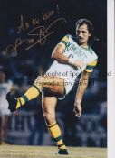
No Image Lot 1266 FRANK WORTHINGTON Autographed 12 x 8 col photo of Worthington in full length action for the Tampa 1266FRANK WORTHINGTON Autographed 12 x 8 col photo of Worthington in full length action for the Tampa Sportingold Limited FRANK WORTHINGTON Autographed 12 x 8 col photo of Worthington in full length action for the Tampa Bay Rowdies, c1981, signed All The Best in ... Live
No Image Lot 189 A quantity of pictures, map and similar 189A quantity of pictures, map and similar Pump House Specialist Auctions Ltd A quantity of pictures, map and similar Add to watchlist Live
No Image Lot 309 A set of vintage maps, 309A set of vintage maps, Pump House Specialist Auctions Ltd A set of vintage maps, Add to watchlist Live
No Image Lot 321 A selection of vintage pictures and maps one depicting Russia in Asia 321A selection of vintage pictures and maps one depicting Russia in Asia Pump House Specialist Auctions Ltd A selection of vintage pictures and maps one depicting Russia in Asia Add to watchlist Live
No Image Lot 408 An antique map of Hertfordshire and two other reproduction maps 408An antique map of Hertfordshire and two other reproduction maps Pump House Specialist Auctions Ltd An antique map of Hertfordshire and two other reproduction maps Add to watchlist Live
No Image Lot 539 FIVE BOXES OF MIXED SUNDRIES to include an extensive array of 1930s Ordnance Survey Road Maps of the 539FIVE BOXES OF MIXED SUNDRIES to include an extensive array of 1930s Ordnance Survey Road Maps of the Richard Winterton Auctioneers FIVE BOXES OF MIXED SUNDRIES to include an extensive array of 1930s Ordnance Survey Road Maps of the Midlands, South of England, and Wales, a smal... Add to watchlist Live
No Image Lot 1250 A mid century German educational world map 1250A mid century German educational world map Gorringes A mid century German educational world map Add to watchlist Live
No Image Lot 1733 After Johannes Blaeu (Dutch, 1596-1673), hand coloured engraved map ‘’Surria vernacule Surrey’’, 1733After Johannes Blaeu (Dutch, 1596-1673), hand coloured engraved map ‘’Surria vernacule Surrey’’, Gorringes After Johannes Blaeu (Dutch, 1596-1673), hand coloured engraved map ‘’Surria vernacule Surrey’’, text verso, 38 x 48.5cm Add to watchlist Live
No Image Lot 1788 William Darton (1755-1819), folding hand coloured map, New and Correct Plan of London and 1788William Darton (1755-1819), folding hand coloured map, New and Correct Plan of London and Gorringes William Darton (1755-1819), folding hand coloured map, New and Correct Plan of London and Westminster with the Latest Improvements, publ. 1814, Wi... Add to watchlist Live
No Image Lot 31 A framed and glazed hand coloured map of Lincoln, 31A framed and glazed hand coloured map of Lincoln, Clarke and Simpson Auctions A framed and glazed hand coloured map of Lincoln, Derby, Stafford, Nottingham, Leicester, Norfolk Add to watchlist Live
No Image Lot 32 Robert Morden, hand coloured map of Scotland 32Robert Morden, hand coloured map of Scotland Clarke and Simpson Auctions Robert Morden, hand coloured map of Scotland Add to watchlist Live
No Image Lot 33 A hand coloured map of the road from London to Fla 33A hand coloured map of the road from London to Fla Clarke and Simpson Auctions A hand coloured map of the road from London to Flambrugh Add to watchlist Live
No Image Lot 91 A War Office Dept. folding map, Ordnance Survey Of 91A War Office Dept. folding map, Ordnance Survey Of Clarke and Simpson Auctions A War Office Dept. folding map, Ordnance Survey Office Southampton, dated 8th May 1871 Add to watchlist Live
No Image Lot 256 Coloured map of North Norfolk, framed and glazed 256Coloured map of North Norfolk, framed and glazed Keys Fine Art Auctioneers Coloured map of North Norfolk, framed and glazed Add to watchlist Live
No Image Lot 306 A world globe on stand 306A world globe on stand Clarke and Simpson Auctions A world globe on stand Add to watchlist Live
No Image Lot 335 A map of The Liverpool Overhead Railway, Principle 335A map of The Liverpool Overhead Railway, Principle Clarke and Simpson Auctions A map of The Liverpool Overhead Railway, Principle Buildings and the Famous Docks Add to watchlist Live
No Image Lot 342 Coloured print, "East Coast Types" 342Coloured print, "East Coast Types" Clarke and Simpson Auctions Coloured print, "East Coast Types" Add to watchlist Live
No Image Lot 515 A framed and glazed map and various rolled maps, n 515A framed and glazed map and various rolled maps, n Clarke and Simpson Auctions A framed and glazed map and various rolled maps, newspapers etc. Add to watchlist Live
No Image Lot 521 A large framed coloured print of a river scene 521A large framed coloured print of a river scene Clarke and Simpson Auctions A large framed coloured print of a river scene Add to watchlist Live
No Image Lot 731 A large quantity of artists colouring pencils 731A large quantity of artists colouring pencils Clarke and Simpson Auctions A large quantity of artists colouring pencils Add to watchlist Live
No Image Lot 732 A large quantity of artists colouring pencils 732A large quantity of artists colouring pencils Clarke and Simpson Auctions A large quantity of artists colouring pencils Add to watchlist Live
No Image Lot 758 A quantity of jumbo sized colouring pencils 758A quantity of jumbo sized colouring pencils Clarke and Simpson Auctions A quantity of jumbo sized colouring pencils Add to watchlist Live
No Image Lot 759 A quantity of jumbo sized colouring pencils 759A quantity of jumbo sized colouring pencils Clarke and Simpson Auctions A quantity of jumbo sized colouring pencils Add to watchlist Live
No Image Lot 785 Four boxes of miscellaneous books, maps etc. 785Four boxes of miscellaneous books, maps etc. Clarke and Simpson Auctions Four boxes of miscellaneous books, maps etc. Add to watchlist Live
No Image Lot 786 A box of miscellaneous maps etc. 786A box of miscellaneous maps etc. Clarke and Simpson Auctions A box of miscellaneous maps etc. Add to watchlist Live
No Image Lot 904 A box of miscellaneous maps, games etc. 904A box of miscellaneous maps, games etc. Clarke and Simpson Auctions A box of miscellaneous maps, games etc. Add to watchlist Live
No Image Lot 945 A quantity of various prints, maps etc. 945A quantity of various prints, maps etc. Clarke and Simpson Auctions A quantity of various prints, maps etc. Add to watchlist Live
No Image Lot 945 Vietnam War Era US Compass Dated 1965 & Jungle Map. 945Vietnam War Era US Compass Dated 1965 & Jungle Map. Cadmore Auctions Ltd Vietnam War Era US Compass Dated 1965 & Jungle Map. Add to watchlist Live
No Image Lot 1136 A collection of various unframed maps 1136A collection of various unframed maps Clarke and Simpson Auctions A collection of various unframed maps Add to watchlist Live
No Image Lot 1202G A collection of World War II Ordnance Survey maps, maps of parts of Malaya, Singapore and Jahore, 1202GA collection of World War II Ordnance Survey maps, maps of parts of Malaya, Singapore and Jahore, Piers Motley Auctions A collection of World War II Ordnance Survey maps, maps of parts of Malaya, Singapore and Jahore, together with some 1946 newspapers. Add to watchlist Live
No Image Lot 1211 A soil leveller 1211A soil leveller Clarke and Simpson Auctions A soil leveller Add to watchlist Live
No Image Lot 1354 A reproduction map of The American Southeast in 1606, F & G, 44 x 56cm 1354A reproduction map of The American Southeast in 1606, F & G, 44 x 56cm Piers Motley Auctions A reproduction map of The American Southeast in 1606, F & G, 44 x 56cm Add to watchlist Live
No Image Lot 1355 After John Speede, a hand coloured engraved map of Caernarvon, with vignettes of Caernarvon and 1355After John Speede, a hand coloured engraved map of Caernarvon, with vignettes of Caernarvon and Piers Motley Auctions After John Speede, a hand coloured engraved map of Caernarvon, with vignettes of Caernarvon and Bangor39 x 51cm F & G Add to watchlist Live
No Image Lot 1356 After S Robert, a hand coloured map of the British Isles, dated 1757, 49 x 59cm 1356After S Robert, a hand coloured map of the British Isles, dated 1757, 49 x 59cm Piers Motley Auctions After S Robert, a hand coloured map of the British Isles, dated 1757, 49 x 59cm Add to watchlist Live
No Image Lot 1357 After Robert Morden, hand coloured map North Wales, 36 x 43.5cm F & G 1357After Robert Morden, hand coloured map North Wales, 36 x 43.5cm F & G Piers Motley Auctions After Robert Morden, hand coloured map North Wales, 36 x 43.5cm F & G Add to watchlist Live
No Image Lot 1358 Robert Morden, a hand coloured map 'The West Riding of Yorkshire, F & G 36 x 42cm. 1358Robert Morden, a hand coloured map 'The West Riding of Yorkshire, F & G 36 x 42cm. Piers Motley Auctions Robert Morden, a hand coloured map 'The West Riding of Yorkshire, F & G 36 x 42cm. Add to watchlist Live
No Image Lot 1359 John Speede, a hand coloured map of Cambridgeshire, double framed showing an alphabetical table of 1359John Speede, a hand coloured map of Cambridgeshire, double framed showing an alphabetical table of Piers Motley Auctions John Speede, a hand coloured map of Cambridgeshire, double framed showing an alphabetical table of all the towns dated 1610, 42 x 55cm F & G Add to watchlist Live
No Image Lot 1360 John Speede, hand coloured map of Buckingham, , inset town plans of Buckingham and Reading dated 1360John Speede, hand coloured map of Buckingham, , inset town plans of Buckingham and Reading dated Piers Motley Auctions John Speede, hand coloured map of Buckingham, , inset town plans of Buckingham and Reading dated 1610, 38 x 51cm. Add to watchlist Live
No Image Lot 1361 John Speede, a double sided hand coloured engraved map of Wales, twelve oval vignettes of 1361John Speede, a double sided hand coloured engraved map of Wales, twelve oval vignettes of Piers Motley Auctions John Speede, a double sided hand coloured engraved map of Wales, twelve oval vignettes of principal cities to the margins and inset views of Bang... Add to watchlist Live
No Image Lot 867 Quantity of Ordnance Survey and other maps 867Quantity of Ordnance Survey and other maps Keys Fine Art Auctioneers Quantity of Ordnance Survey and other maps Add to watchlist Live
No Image Lot 910 Reproduction coloured map of Siam 910Reproduction coloured map of Siam Keys Fine Art Auctioneers Reproduction coloured map of Siam Add to watchlist Live
Reserve not met No Image Lot 60 After Peter J.Sterkenburg (Dutch,1955-2000), 'Dutch Harbour entrance of Harlingen (important 60After Peter J.Sterkenburg (Dutch,1955-2000), 'Dutch Harbour entrance of Harlingen (important Keys Timed After Peter J.Sterkenburg (Dutch,1955-2000), 'Dutch Harbour entrance of Harlingen (important commercial harbour town in the Netherlands between (1... Add to watchlist Timed
Reserve not met No Image Lot 176 TR16305 † A map of Africa, in a glazed and ebonized frame. H.102 W.79cm. 176TR16305 † A map of Africa, in a glazed and ebonized frame. H.102 W.79cm. Criterion Auctioneers Ltd TR16305 † A map of Africa, in a glazed and ebonized frame. H.102 W.79cm. Add to watchlist Timed
Reserve not met No Image Lot 136 SEVEN CONIC PROJECTION MAPS T/W BRITISH EMPIRE MAPS 136SEVEN CONIC PROJECTION MAPS T/W BRITISH EMPIRE MAPS Auctioneum Ltd - East Bristol & Bath A collection of seven 20th century Conic Projection maps together with another. The lot to include: the map of Iran (Persia) scale 1:4,000,000 pla... Add to watchlist Timed
Reserve not met No Image Lot 198 Modern Reproduction of an antique map of the Cayman Islands. framed and glazed approximately 87 x 198Modern Reproduction of an antique map of the Cayman Islands. framed and glazed approximately 87 x Lyme Bay Auctions Modern Reproduction of an antique map of the Cayman Islands. framed and glazed approximately 87 x 67cm Add to watchlist Timed
Reserve not met No Image Lot 206 Cricket interest print, Pavilion End D E West, approximately 68 x 48 cm framed and glazed 206Cricket interest print, Pavilion End D E West, approximately 68 x 48 cm framed and glazed Lyme Bay Auctions Cricket interest print, Pavilion End D E West, approximately 68 x 48 cm framed and glazed Add to watchlist Timed
No Image Lot 1052 A Book 1052A Book Veilinghuis de Jager Titled Municipal Atlas of the Netherlands, by J. Kuyper, fifth part Zeeland by J Kuyper, fifth part Zeeland. Add to watchlist Live
No Image Lot 1067 A Map of Zeeland 1067A Map of Zeeland Veilinghuis de Jager By F. de Wit, 55 x 46 cm. Add to watchlist Live
No Image Lot 1073 A Map 1073A Map Veilinghuis de Jager Titled ÒProvinces de Pay Bas, Divisees suivant Les TraitesÓ, by Nicolas de Fer, 1716, 61 x 46 cm. Add to watchlist Live
No Image Lot 1375 A Collection of Maps 1375A Collection of Maps Veilinghuis de Jager consisting of 3 floor plans, including Veere, largest 28 x 34 cm. Add to watchlist Live
No Image Lot 1381 A Lot of 2 Maps 1381A Lot of 2 Maps Veilinghuis de Jager Old colored, 58 x 50 cm. Add to watchlist Live
No Image Lot 1396 A Map of Portugal and Spain 1396A Map of Portugal and Spain Veilinghuis de Jager From Atlas Major by Frederick de Wit (1610 - 1698), 55 x 46 cm. Add to watchlist Live
No Image Lot 1739 A Kiss Relic 1739A Kiss Relic Veilinghuis de Jager In which relic of Saint Jan Berchmans, diameter 11 cm. Add to watchlist Live
No Image Lot 1786 A Ciboria 1786A Ciboria Veilinghuis de Jager Bruges, with engraved text and tendrils, height 37 cm. Add to watchlist Live
No Image Lot 117 BUTLER, Samuel. An Atlas of Ancient Geography, complete with 21 copper-engraved maps, hand- 117BUTLER, Samuel. An Atlas of Ancient Geography, complete with 21 copper-engraved maps, hand- Hansons Auctioneers and Valuers BUTLER, Samuel. An Atlas of Ancient Geography, complete with 21 copper-engraved maps, hand-coloured in outline, internally well-preserved with cre... Add to watchlist Live
No Image Lot 118 Cruchley's Ordnance Map, No. 32, hand-coloured, dissected and linen-backed, publisher's green 118Cruchley's Ordnance Map, No. 32, hand-coloured, dissected and linen-backed, publisher's green Hansons Auctioneers and Valuers Cruchley's Ordnance Map, No. 32, hand-coloured, dissected and linen-backed, publisher's green cloth covers lettered in gilt, n.d.; 70 Miles About ... Add to watchlist Live
No Image Lot 126 Collection of World War II era ordnance survey maps, together with a small quantity of First Day 126Collection of World War II era ordnance survey maps, together with a small quantity of First Day Lawrences of Bletchingley Collection of World War II era ordnance survey maps, together with a small quantity of First Day postal covers and a small quantity of loose cigar... Add to watchlist Live
No Image Lot 237 A Cleveland Dailey Herald Newspaper November 16th 1877 With a detailed account by Sitting Bull of 237A Cleveland Dailey Herald Newspaper November 16th 1877 With a detailed account by Sitting Bull of Hansons Auctioneers and Valuers A Cleveland Dailey Herald Newspaper November 16th 1877 With a detailed account by Sitting Bull of General Custers Last Stand. 35.5cm x 46.5cm... Add to watchlist Live